
Hiking

Stavsro to Gaustatoppen Hiking Trail
The trail from Stavsro to Gaustatoppen provides hikers with a memorable experience of Norwegian nature. Covering a distance of 4.3 kilometers, this trail starts from the base at Stavsro and ascends towards the peak of Gaustatoppen, reaching an altitude of 1,883 meters.
Classified as a moderate hike, it's suitable for a wide range of hikers, from enthusiastic beginners to experienced trekkers. As one progresses along the trail, they're met with a variety of scenic views that showcase the best of Norway's landscape: rolling hills, clear blue lakes, and dense, green forests. Once at the top of Gaustatoppen, on days with good visibility, hikers are treated to an expansive view that encompasses a significant portion of mainland Norway.
An interesting feature of Gaustatoppen is the Gaustabanen, an underground funicular railway. Originally constructed during the Cold War period, today it offers an alternative way to reach the summit, especially for those who might find the hike challenging.
The Stavsro to Gaustatoppen trail, with its blend of natural beauty and a hint of history, stands as a testament to Norway's rich outdoor offerings and is a recommended trail for anyone visiting the region.

Hiking from Svineroi to Gaustatoppen
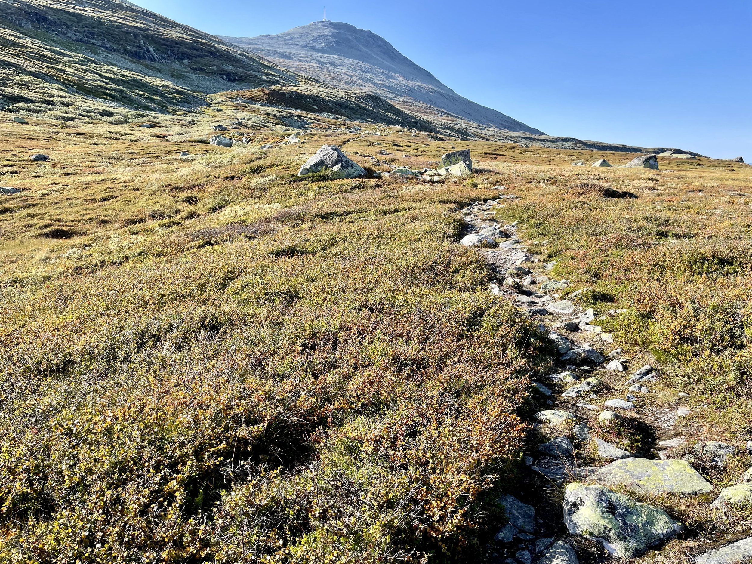
Nestled within the scenic backdrop of Telemark, Norway, the trail from Svineroi to Gaustatoppen is a testament to the region's unparalleled natural beauty. Starting at Svineroi, hikers embark on a journey that traverses a diverse array of landscapes, from verdant meadows dotted with wildflowers to rugged terrain marked by boulders and rocky outcrops.
The route, covering a moderate distance, is peppered with glimpses of Norway's picturesque wilderness. Streams fed by melting snow offer cool respite, while expansive views of rolling hills and valleys stretch out beneath a vast sky. As one nears Gaustatoppen's peak, standing tall at 1,883 meters, the horizon broadens, offering a breathtaking panorama that captures a significant portion of mainland Norway.
The trail, though accessible to most, does have its challenging moments, making the summit's vistas all the more rewarding. Along the way, markers and resting spots provide guidance and moments of reflection. The Svineroi to Gaustatoppen path is not just about the destination but the journey itself, with its undulating paths, occasional wildlife sightings, and the sense of serenity that envelopes hikers in the embrace of nature.
In essence, this hike is a delightful blend of challenge, discovery, and unparalleled scenic beauty.

Solstien (The Sun Path):
Length: The trail is about 1.5 km long one way and can take about 30-45 minutes to walk up.
Difficulty: It's graded as a blue trail, meaning it's of moderate difficulty. Most people with average fitness should be able to complete it, but there are some steep sections.
Route: The trail starts in Rjukan town and ends at the sun mirror's viewpoint. Along the path, there are several information boards explaining the history of Rjukan and the sun mirror project.
Views: Once at the top, besides getting a close look at the sun mirrors, one can enjoy a panoramic view of the town of Rjukan, the surrounding mountains, and the Gaustatoppen, which is Telemark's highest mountain.
Facilities: There's a parking facility near the starting point of the trail. Some benches along the path allow for breaks and taking in the views.
If you're visiting Rjukan, walking the Solstien trail provides an opportunity to not only understand the innovative sun mirror solution but also to soak in some of the most breathtaking views the region has to offer.